-
Chapter 7: NORTH AMERICA
Introduction
The
continent has Rocky mountain ranges to western side and
Appalachian mountains to the eastern coast. In between the
ranges the Great plains are present called Prairies “Granaries
of the World”.
Prairies
lie in USA and 3 states of Canada. They are temperate grasslands
with nutritious grass known for wheat cultivation and animal
rearing.
This
continent has the largest coastline.
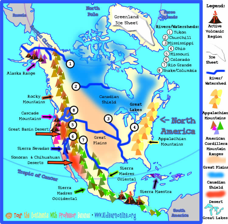
Fig 1: North America landforms
Shale
gas reserves are found in huge proportions in the US.
The US has overtaken Russia as the largest gas producer and Saudi as the largest oil producer. This led to low imports for US and boosted manufacturing there.
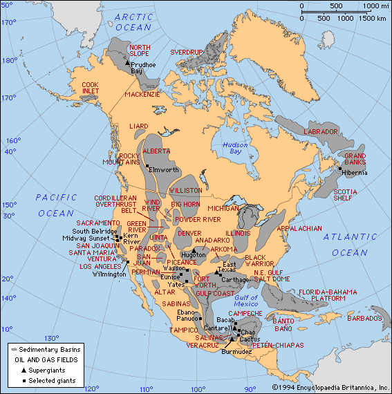
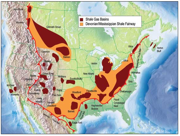
Fig 4: Shale gas reserves
Agriculture
Agriculture
pattern from east to west is cotton and tobacco, followed by
corn and soybean belt and then wheat belt in prairies.
The Appalachian mountains are old fold mountains which are a source of coal – bituminous, anthracite.
Ocean continent collision led to ocean plate Farallon subdued under north American plate. This led to extensive volcanism and formation of rockies. Colorado plateau is also seen.
San Andreas fault was formed due to transverse plate movement i.e. the north American plate moving south west and pacific plate moving north west.
Rivers
Rivers of USA are Mississippi river, Colorado, Hudson, Rio Grande and Columbia river. The Rio Grande is at the border of USA and Mexico. Mississippi is the most important river system in USA. It is the second largest river after Missouri and empties into the Atlantic ocean.
Great lakes are at the boundary of USA and Canada. Lakes are superior, Michigan, Hudson, Ontario and Erie. It is a largest, freshwater glacial system. Together holds almost 1/5th of the earths fresh water.
Lake Michigan is the largest lake fully within a country.
USA
has 4 deserts, 3 on the west coast and 1 along Mexican border.
It has 50 states and 9 time zones.
Canada has a flourishing paper and lumber industry. This is due to temperate forests, hydroelectricity from rivers and labor. It also has a large uranium reserve [22% of the world]. Climate is tundra and taiga type.
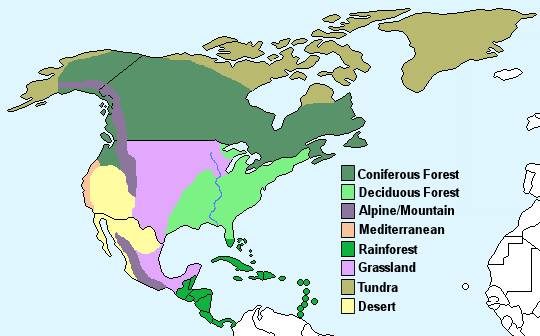
Fig 5: North American climate zones
Miscellaneous
- Mexico city is the largest city in North America.
- Only continent that has all types of climate and all types of biomes i.e. grassland, marine, desert etc
- 24 countries are in it.
- Mount McKinley, Alaska is the tallest mountain.
- Death valley, California is the lowest point on it.
- US second largest coal producer after China. India is 4th largest.
Chapter Review
Score more than 80% marks and move ahead else stay back and read again!